In 1795 work started on the construction of the Wilts & Berks canal. It would join the Kennet & Avon at Semington Junction to the Thames at Abingdon. It took 15 years to complete and was officially opened in 1810. Four years later work began on the North Wilts Canal that would link the Wilts & Berks to the Thames and Severn Canal. This was late in the years of canal mania that swept the country during the Industrial Revolution but together the canals opened the west and, more importantly, the Somerset Coalfields to trade to the north and east.
It probably wasn't realised at the time, but the canal was to play a part in its own decline. In 1835 a proper genius of a chap, Isambard Kingdom Brunel (well, you're fated for great things with a name such as that), was employed to engineer the Great Weston Railway. Proper stuff too, it was broad gauge and everything, and linked Bristol to London. The canal was used to transport construction materials and probably workers along the planned route. Most of the track was built less than a mile from the canal.
The waterway probably hadn't seen so much activity before. However, when the GWR opened it provided a more economically viable means of transporting goods across the south than by water. The shift to the railways allowed the price of transportation to drop and the canal corporations couldn't compete. By the end of the century the Wilts & Berks carried very little traffic and the decrease in revenue meant it was unable to pay for its own upkeep. As the canal began to silt up boats were forced to carry less as, when fully laden, the maximum draft would cause vessels to ground. The Wilts & Berks Canal Trust cite that the last recorded boat at Wantage Wharf in the mid 1890s was only able to carry 17 tons instead of the maximum 34 tons.
And, as though to cause insult to injury, a storm in 1901 caused part of the Stanley Aqueduct over the River Marden to collapse thus draining a section of the canal. There was no money and no pressing reason to repair it. Technology had moved on and the railways were blazing a trail to a modern, more sophisticated, future.
The end of the Wilts & Berks Canal finally came in 1914 when an Act of Abandonment was passed by Parliament. This allowed the land adjoining the canal to be sold and, in some areas, redeveloped. Many of the original structures have been damaged or demolished, most notably by the army who used them for demolition exercises during WWII.
But not all is lost. There are people out there who still see the value of canals – and rightly so. In the 1970s a society was formed to protect The Wilts & Berks Canal and the North Wilts Canal from further development and destruction. Today the Wilts & Berks Canal Trust is actively restoring these old networks. By 2025 there will again be traffic on this once abandoned canal system and you too can be part of its rebirth.
Get involved and help save our waterways.
Abingdon

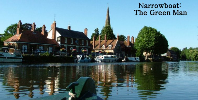
The canal joins the Thames beside Margaret Brown Gardens on Wilsham Road.

Across the road is an old foundry building. The wall on the left used to be part of a lock which opened into a basin. It is now a car park. Houses have been built over the route of the old system here but the line of the canal can be followed along Caldecott Road.

Caldecott Road.

The course of the old canal runs parallel to the Ock stream. This picture shows the line it takes as it emerges from the housing estate off Mill Road.

Following the lane at the bottom of Mill Road the trail leads out of Abingdon and into the countryside towards Drayton.

Under the low bridge of the A34, we followed the Ock. The canal is on your left as you walk west.

The canal resembles more of a ditch than a canal at this point but you can follow it as the fields curve towards Drayton Lock.
More to follow.
References:
The Wilts & Berks Canal Trust
Wikipedia
North Wilts Canal
The Great Western Archive
